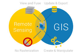
Ph.D. in Remote Sensing and GIS Applications is a research-oriented program that uses geographic information systems (GIS) and remote sensing technology to examine and analyze spatial data. The program typically lasts three to five years and covers topics such as satellite imagery analysis, spatial data modeling, environmental monitoring, urban planning, and natural resource management. Students undertake innovative research on remote sensing and GIS tools for use in agriculture, climate change, disaster management, and land-use planning. The curriculum covers coursework in data analysis, geospatial technology, and research methods, which culminates in a dissertation. Graduates frequently pursue positions in academia, environmental research, government organizations, or enterprises that use geospatial data.